Off-Road Trails

We have two brochures you can download, one for all of the White Springs trails, and one for the trails around Ellaville.

Big Shoals Big Shoals Big Shoals

Big Shoals Conservation Area

5 to 25 miles - Intermediate to Challenging
Map Strava

Modified Big Shoals: Strava

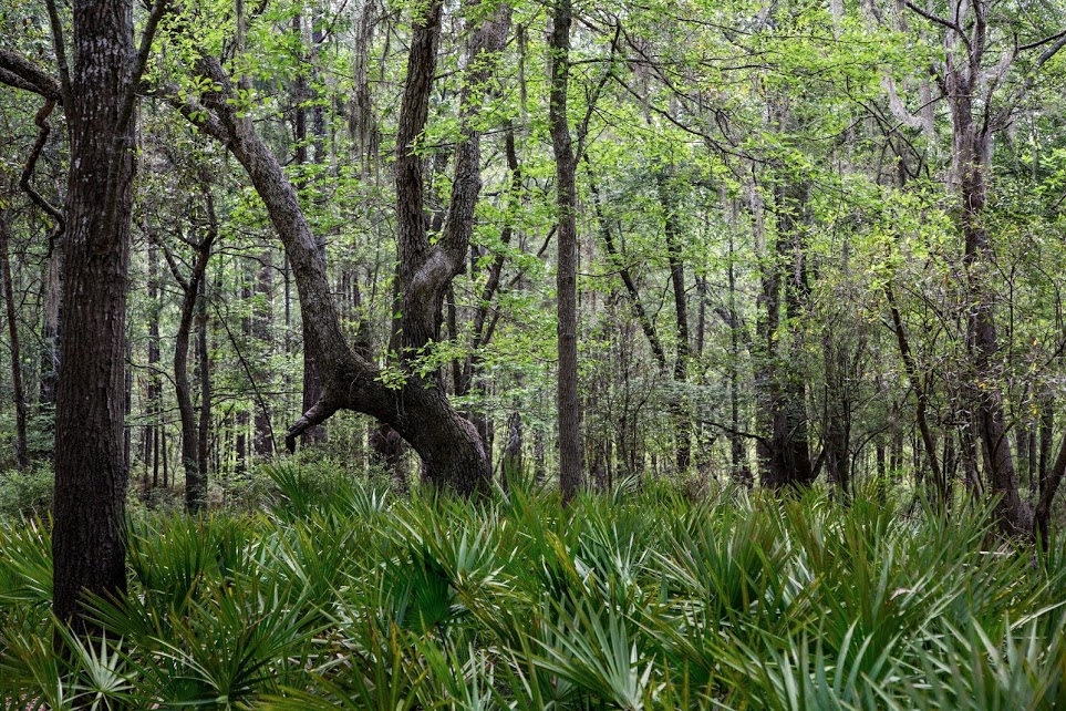
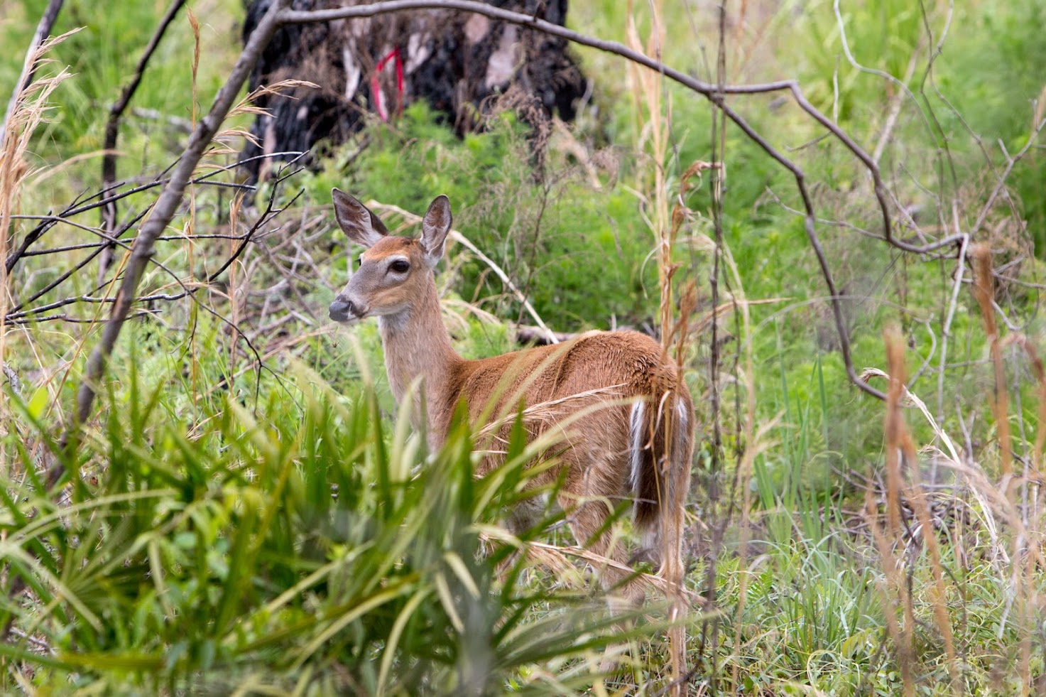
Description: Big Shoals Public Lands is more than 4,000 acres, managed jointly by SRWMD, Florida Division of Forestry, Florida State Parks and Florida Wildlife Conservation Commission. This area has varied terrain with scenic vistas from high river bluffs. The land is noted for diverse plant communities and forest types, including swamps, pine flats and mixed hardwood forests. Many gopher tortoise burrows can be found in the state park, where FWC has had an on-going project to reestablish the population. During the hunting season the area hosts limited hunts only. Be sure to check the hunt schedules in the spring and fall.

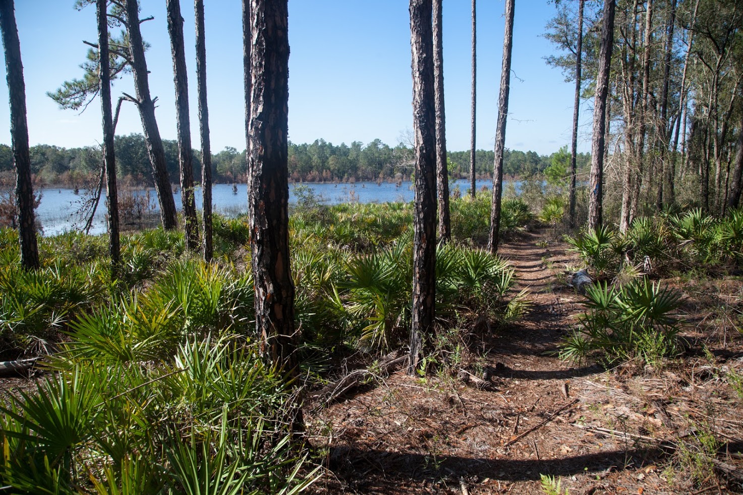
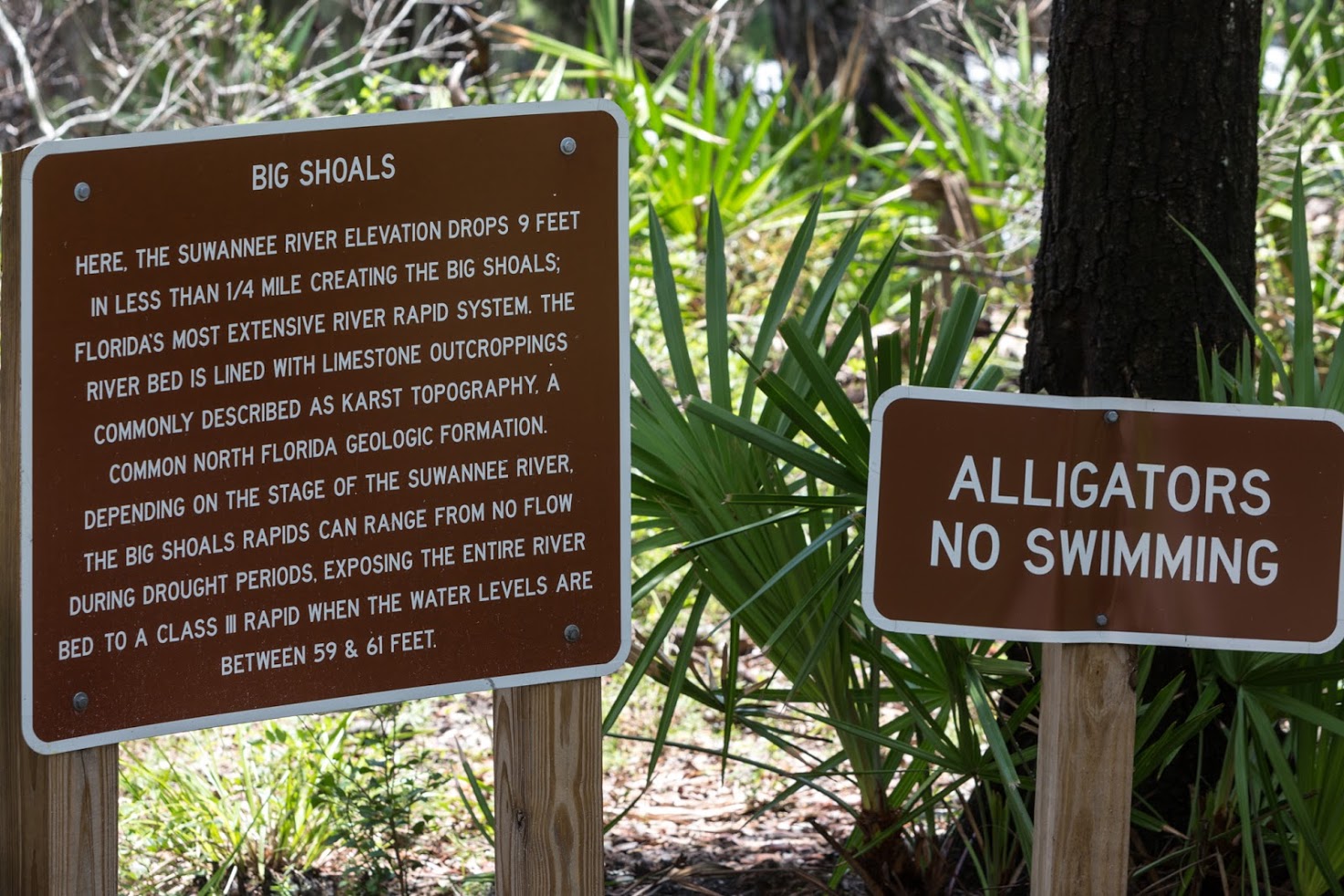
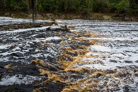
One of the major natural attractions of the area is the Big Shoals of the Suwannee, where the river flows over a series of bedrock ledges and drops to create a spectacular section of white water.

Beavor Loop and Big Shoals

The Big Shoals traditional route starts with the Beavor Loop Trail, on the North side of US 41 before the River (just to the right of Sunshine Drive). Beavor is a nice four-mile loop all by itself. From the Beavor trail, follow the signs for Big Shoals. The single track "Ravine Trail" follows an old wagon road over Bottom Bay Creek and winds through levees and flatwoods to the Little Shoals river overlook. Continue on doubletrack to the Palmetto Trail, a single track which takes you to the Big Shoals overlook. Continue to ride the shared hiking singletrack to the parking lot and picnic area with restrooms. Next ride the Long Branch Loop.

Long Branch

Enter the Long Branch 2-mile single track loop across from the restrooms (by the kayak launch entrance). Along the way, the trail roams through river front land and more open woodland with some elevation differences. There are a couple of bridges, one of which is walking only currently.

After completing this intermediate loop, you can take the scenic 3.2 mile paved Woodpecker Trail back to the main entrance to Big Shoals of off Hwy 135. Another option is to take Road 1, a dirt road that runs parallel to the Woodpecker Trail. Return to White Springs by riding along Hwy 135 for several miles. Alternatively, continue on Road 1 and follow the signs back to the Beavor Loop.

Foster's Hammock Loop

Approx 8 miles - Intermediate to Challenging
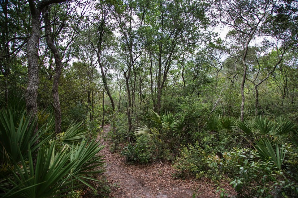
Map Strava

Description: Foster's Hammock Loop Trail is an 8-mile single track mountain bike trail within Stephen Foster Folk Culture Center State Park. It includes Catfish Hole, the Suwannee River Overlook, “Barnett Crossing” and other unique areas along a scenic trail allowing riders to experience the Upper Suwannee River Valley’s diverse topography.

The trail starts at the multi-use parking area in the State Park, near the campground entrance. A short section of singletrack is followed by a bit of doubletrack that bypasses a section that proved too wet for reliable riding. The trail then continues through the woods, making use of the elevation differences of the terrain for challenging riding. SBA is continuing to work with the Park to reroute sections and restore the trail where logging was recently completed.

All Town - Bridge to Bridge, Gar Pond, Beast of Burden

These three trails are often ridden sequentially for more than twenty miles of singletrack. One route is to start by the ballfield entrance to Bridge to Bridge, then a short ride on US 41 over the Suwannee to Gar Pond, and if your legs are up for it, across the street for the Beast. For the truly ambitious, you can add riding Bridge to Bridge backwards or the Beavor Loop on the way back to your starting point.

Bridge-to-Bridge

4.5 miles - Intermediate to Challenging
Map Strava

Description: Located just behind the White Springs ball field and cemetery, Bridge-To-Bridge Trail is about four and a half miles of fun singletrack with plenty of turns, short climbs and descents. The Florida Trail Association (FTA) shares a section of the mountain bike trail. It follows the river for more than a mile with many scenic overlooks. Bridge to Bridge now includes signage. The end of the trail is at HWY 41 boat launch. You can also ride the trail in the reverse direction (from the bridge to the ball park).

Gar Pond

11 miles - Intermediate to Advanced
Map Strava

Description: The trailhead is behind the Ag Station on US 41, next to Billy Bon's Lounge. The route through this area is reasonably well signed, and offers eleven miles of singletrack through a variety of terrain. Gar Pond is a shallow lake (often dry) surrounded by marsh land. Many types of water birds can often be spotted. The first lake on the route is Horse Pond. A third lake, known as the "Pit Pond" was left after excavation for the embankment for the Highway 41 Bridge. There are many sink holes, some also contain water. Watch out for deer, turkeys and tortoises!

Beast of Burden

7 miles - Intermediate to Advanced
Map Strava

Description: It’s not called the Beast for nothing. This challenging single track includes a wide variety of terrain. This trail is signed. Access the trail from the dirt road across the railroad tracks from the Ag. Station (entrance to Gar Pond). The entrance on the left is known as Little Beast. There is also a 2-mile section known as the Lollipop loop, defined by a gravel stream crossing. After riding Lollipop, the trail climbs up the hill for additional twists and turns back to the starting point.

Gar Pond
Palms

Live Oak Trails - Anderson Springs, Big Oak

These two trails are a thirty-five minute drive from White Springs, and well worth the effort. Each has its own parking lot, or you can park along US 90 by the Ag. Station, close to both trailheads.

Anderson Springs

Approx 7 miles - Intermediate
Map Trailhead

Description: This loop trail is located in the Anderson Springs Tract of Twin Rivers State Forest, along the Suwannee River, about four miles from Suwannee River State Park. The entrance is at 5285 River Road, Live Oak, just south of the I-10 crossing. Park in the small parking area at the river. You can ride this trail clockwise starting at the trail entrance between River Road and the river. The first half is through forests. Once you arrive at the river overlook (picnic table), continue to ride along the river back to the picnic parking area. Anderson Spring is a first magnitude spring at the edge of the river. When water levels are high, the spring is covered by tannic river water. But when the river is at lower levels, the spring pumps large quantities of clear water into the river and makes a great swimming place. The trail affords spectacular views of the river, and large sturgeon can often be seen making incredible splashes in the water.

You can ride this trail clockwise starting at the trail entrance between River Road and the river. The first half is through forests. Once you arrive at the river overlook (picnic table), continue to ride along the river back to the picnic parking area. it can also be ridden counter clock wise or as an in and out along the river. This trail is ridden during Dog Days in August and at our other events.

Big Oak

Approx 6 to 18 miles - Intermediate
Map West Map West + Road Map Trailhead

Description: This trail is located (mostly) in Suwannee River State Park on the other side of the Suwannee River from the campground. The trail starts by the Pavilion in the park and crosses the old US-90 bridge over the Suwannee to DeSoto Park, where a delightful trail winds north following the Withlacoochee to the SR 141 bridge. This portion of the trail is 3-mile one way.

Currently (May 2109) the rest of Big Oak is accessible by riding SR 141 over the Withlacoochee to SW 74th St., and then riding it and on to Seven Sisters Boat Ramp parking lot. This is the entrance to the main loop of Big Oak singletrack trail following the Suwannee down to its confluence with the Withlacoochee, and then up the Withlacoochee before cutting back to the exit. (There are plans for an access to this trail which would eliminate riding to 74th St.)

For a shorter ride, you can drive to the trail head at the Seven Sisters Boat Ramp parking lot. The main loop is 6.5 miles long, and the road between the two pieces of singletrack is 2.5 miles.

Foster Hammock Riders
Trail
Deer